
The Limits of Download-First Workflows
When Esri recently published a tutorial on downloading GBIF biodiversity data, it showed the classic workflow that has defined GIS for decades: download, clean, process, visualize. That’s the way it’s always been done — and it still works for small, one-off projects. But at scale, when the goal is to combine biodiversity with climate, land use, or socioeconomic datasets, that approach breaks down.
At SeerAI, we’ve had a live connection to GBIF for nearly three years. And unlike the download-first model, we don’t download at all. The Geodesic platform connects directly, streams observations in real time, computes on demand, and organizes data in context so it can be fused with anything else. Instead of static files that grow stale and duplicated, biodiversity data becomes a living resource — ready for analysis, ready for action.
Migration Without Downloads
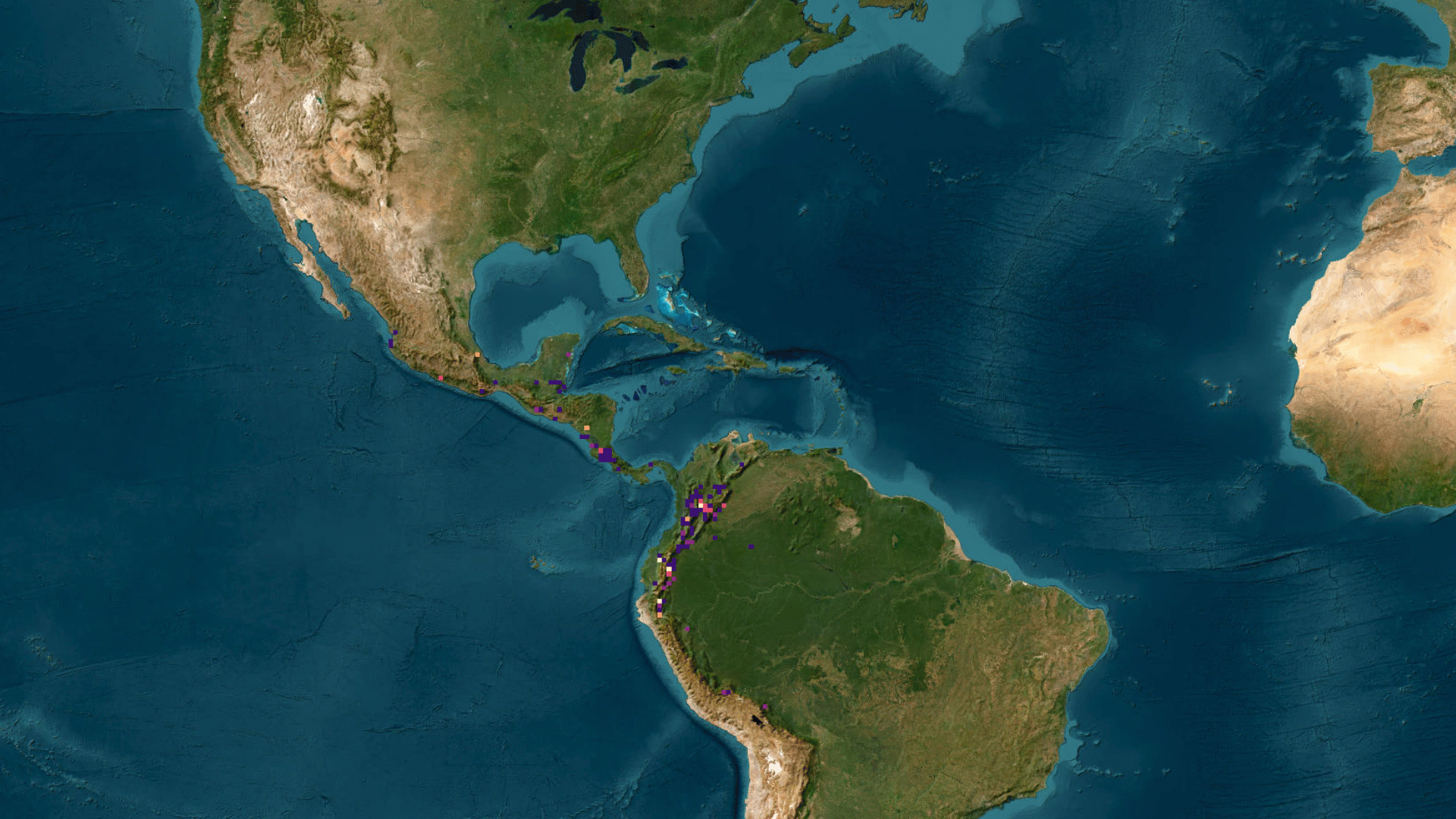
Take Swainson’s Thrush, a migratory bird species. In the Esri tutorial, you’d export the GBIF dataset, clean it locally, then bring it back into ArcGIS for visualization. With Geodesic, we stream GBIF records as they’re needed, aggregate them weekly, and animate their migration across the continent in minutes. The result is an interactive visualization you can share immediately — no CSVs, no staging servers, no duplication.
That’s the real difference:
Esri’s approach: Download → Clean → Process → Visualize Geodesic’s approach: Connect → Stream → Compute → Share
Once the data is flowing, visualization is only the start. Because it’s organized within Geodesic’s knowledge environment, GBIF can be combined with NDVI, air quality, or land use data to explore the drivers of biodiversity change. Migration patterns can be correlated with climate anomalies. Species richness can be studied alongside human activity.
The point isn’t prettier maps. It’s making biodiversity data usable in context, at scale, without the overhead.
The Bigger Picture
The truth is this isn’t really about GIS at all. It’s about data. Whether you’re studying bird migrations, modeling climate risk, or running financial analytics, the bottleneck is the same: too much time spent wrangling, not enough time making decisions.
Esri’s GBIF tutorial shows what’s possible with downloads. SeerAI’s Geodesic platform shows what’s possible without them. And that shift — from download-first to live, contextual data — is the future of data infrastructure.